Christina Lake and the Boundary Region are gifted with an abundance of wildlife, which requires extra caution when driving in the area, especially at dusk or at night. Be on the lookout for movement on or at the sides of the road, and approach slowly as wildlife can be unpredictable.

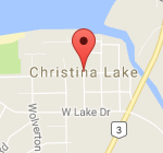
Travel North along Highway #395/U.S. 395 to the U.S. Canada border at Cascade/Laurier crossing. Continue on Highway #395/U.S. 395 to the junction of Highway #3 . Turn right onto Highway #3 and continue down the hill into the townsite of Christina Lake. See the Border Crossings page for customs hours, documentation requirements and traveler info.
Travel North along Highway #395/U.S. 395 to the U.S. Canada border at Cascade/Laurier...


Travel West along Highway #3 West. You will arrive at the Mid point of the Lake. Continue to travel another 10 kms to the townsite at the South end of the Lake.
Travel West along Highway #3 West. You will arrive at the Mid point...


Travel East along Highway #3 East to Christina Lake. You will arrive at the south end of Christina Lake and at the town site.
Travel East along Highway #3 East to Christina Lake. You will arrive at...


DriveBC provides current road conditions for highways within the Province of BC. Click here for the Christina Lake highway cam, looking northwest on Highway #3 at East Lake Drive. Click here for current road and weather conditions in Washington State.
DriveBC provides current road conditions for highways within the Province of BC. Click...
