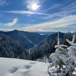
We are excited to share our beautiful trails and backcountry with you, one step at a time! Snowshoes can be picked up and dropped off by users at the Visitor Centre kiosk at 1675 Hwy 3 Rental equipment may be transported to other locations within the region.
We are excited to share our beautiful trails and backcountry with you, one...
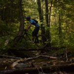
The outdoorsy culture here at Christina lake grows more and more each year with new trails being made by the locals, old trails being rediscovered, and growing community events around biking as a whole. We are positive there is a trail for everybody here at The Lake, as well as that there is no reason to be...
The outdoorsy culture here at Christina lake grows more and more each year...

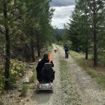
Accessibility at the Christina Lake Provincial Park Our Christina Lake Provincial Park has recently become one of few BC Parks with access to a Mobi-Mat, a specialized floating chair, and accessible parking spaces. These features are wonderful additions for those who require them, but also are intended to be a reflection of the community's strength when we...
Accessibility at the Christina Lake Provincial Park Our Christina Lake Provincial Park has...


This trail offers moderate biking and an easy hike. There are some great viewpoints overlooking the Kettle Valley and south into the USA. This historical trail is over 150 years old, being the original horse pack route through the region. Distance: 4.6 km plus 2.3 km road in from Santa Rosa Difficulty: Hike: Easy Bike: Moderate/Difficult Elev....
This trail offers moderate biking and an easy hike. There are some great...


A technical single-track that follows along the creek and joins a fire access road. Use this trail as the start to the Deer Point/ Troy Creek trail. An easy and scenic hike. Distance : 2 km Difficulty : Hike: Easy Bike: Moderate Time : Hike: 30 min Uses : Hiking & Biking Trail Head Access : Take...
A technical single-track that follows along the creek and joins a fire access...

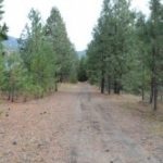
This stretch gives you the same panoramic views as the previous, with the entrance off Fife Road. After a short walk though the trees, the trail opens to a gully where Sutherland creek flows beneath. At a moderate pace, the first viewpoint is roughly twenty-five minutes in with two more vantage points not much further on. From...
This stretch gives you the same panoramic views as the previous, with the...

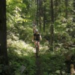
Nestled in the south east corner of the lake just off Highway #3, our Community Nature Park offers year round sanctuary. It is the perfect place to take a quiet stroll with the family, a short bike ride, or enjoy an leisurely summer afternoon with a picnic. Fall brings a festival of colors with the autumn foliage...
Nestled in the south east corner of the lake just off Highway #3,...


This is one of the few trails in this region located in an alpine setting. It follows the ridge line from the Santa Rosa summit to Mt. St. Thomas and is a multi-day hike or a long day biking. Be prepared for a rugged backcountry experience and bring water as none is available along route. This trail...
This is one of the few trails in this region located in an...

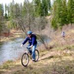
This trail follows along the shores of Christina Creek, the only outflow of Christina Lake. It covers a short distance making it accessible to most ages and abilities. In places the trail dips down offering access to sandbars and pools along the creek. There is ample opportunity to view the abundant wildlife. Keep an eye out for...
This trail follows along the shores of Christina Creek, the only outflow of...


Ideal for a family hike or bike, the old Kettle Valley Railway was decommissioned several years ago and is now part of the Trans Canada Trail. The Cascade Gorge area offers a great variety of sights and viewpoints, and is one of the most popular areas to explore around the lake. Along with the spectacular natural scenery...
Ideal for a family hike or bike, the old Kettle Valley Railway was...

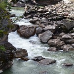
Carved over millions of years as the Kettle River scoured through its metamorphic rock, the Cascade Gorge is one of our most treasured natural attractions. In the spring, the winter melt off surges through the canyon with an awesome display of power; by the end of summer the water levels recede to reveal the series of "kettles"...
Carved over millions of years as the Kettle River scoured through its metamorphic...


This short trail connects McRae Creek Road to Biner Road, which is the trailhead of the Deer Point Trail. A moderate hiking trail with frequent views of Christina Lake. Suitable for most ability levels, though those with bad knees may want to avoid the section with rocky steps at the McCrae Creek end of the trail. Badger...
This short trail connects McRae Creek Road to Biner Road, which is the...


In for the ride of your season? Check out Spooner Creek Trail. This trail is a classic single-track mountain bike trail providing some climbing, steep descents, technical sections, and optional stunts. It provides great viewpoints looking east over Christina Lake. Distance : 4.25 km Difficulty : Hike: Moderate - Difficult Bike: Difficult Time : Hike: 1 -...
In for the ride of your season? Check out Spooner Creek Trail. This...


This trail is steep in sections and is popular with mountain bikers. It provides a moderate hike leading to some viewpoints of the lake and valley near the top. As a hike it has some steep and loose sections. Distance : 3.5 km, plus 1.2 km in from Santa Rosa Difficulty : Hike: Moderate Bike: Moderate/Difficult Elev....
This trail is steep in sections and is popular with mountain bikers. It...

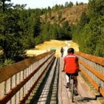
This hike includes crossing the Kettle River downstream of the falls on a 505 foot trestle bridge (Kettle River Bridge #5, now the Smitten Trestle), one of the longest on the Canadian Pacific Railway, which was redecked in 2004 as a joint military exercise with the CME and British and New Zealand troops. While approaching the bridge,...
This hike includes crossing the Kettle River downstream of the falls on a...

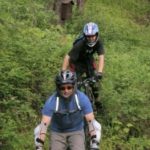
This former logging road was de-activated many years ago and now provides an easy hiking/biking trail that leads from Santa Rosa Rd. to Fife Rd. There are some great viewpoints along the trail of the Christina Lake valley, Grand Forks and Laurier as it follows through a 2nd growth forest, abundant with wildlife. The trail rises 340m...
This former logging road was de-activated many years ago and now provides an...

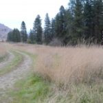
he region's newest Provincial Park offers a level grade through the wide open grasslands and dry forest, for relaxed hiking or bike riding. Established to protect the feeding and critical winter habitat for a large population of whitetailed and mule deer, elk and bighorn sheep, the scenery is panoramic, with the Kettle River flowing to the south...
he region's newest Provincial Park offers a level grade through the wide open...


This is another classic single-track mountain bike trail with a few steep technical descents. As a hiking trail it is loose and steep in sections but follows along the ridgeline providing spectacular scenic views of Christina Lake to the east and south. The steep up-hill sections and technical descents will keep all types of mountain bikers entertained....
This is another classic single-track mountain bike trail with a few steep technical...

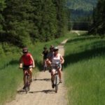
Opening in 2000, the Trans Canada Trail is a 21,500-kilometre recreational trail winding its way through every province and territory, from the Atlantic to Pacific to Arctic Oceans. When completed, it will be the world's longest recreational trail, linking close to 1000 communities and over 33 million Canadians. Now part of the Spirit of 2010 Trail, the...
Opening in 2000, the Trans Canada Trail is a 21,500-kilometre recreational trail winding...


At 25 km for the full trip, this leg of the trail is only for extremely dedicated hikers, as it will take a full day to reach Fife Road, but makes for an excellent half day biking trip. The rewards include passing through Paulson Tunnel, crossing the old Snowslide railway bridge and finally the ore loading tower...
At 25 km for the full trip, this leg of the trail is...
