
This short trail connects McRae Creek Road to Biner Road, which is the trailhead of the Deer Point Trail. A moderate hiking trail with frequent views of Christina Lake. Suitable for most ability levels, though those with bad knees may want to avoid the section with rocky steps at the McCrae Creek end of the trail. Badger...
This short trail connects McRae Creek Road to Biner Road, which is the...

Click here(http://www.geocaching.com/seek/nearest.aspx?lat=49.04031&lng=-118.21398&dist=100)to view Geocaching in Christina Lake
Click here(http://www.geocaching.com/seek/nearest.aspx?lat=49.04031&lng=-118.21398&dist=100)to view Geocaching in Christina Lake


There are two places to mini golf in Christina Lake: 1. Lakeside Mini Golf, which is open from the Beginning of July until the End of August. 2. Christina Pines also offers mini golf.
There are two places to mini golf in Christina Lake: 1. Lakeside Mini...

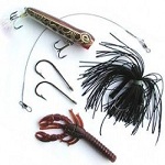
Fishing Tackle and live bait are available at the Christina Lake Marina, Lakeside General Store, Christina Lake Canco and The Sand Dollar Store. Fishing licenses can be purchased online at www.fishing.gov.bc.ca For more information on fishing in Christina Lake got to in BC please visit
Fishing Tackle and live bait are available at the Christina Lake Marina, Lakeside...


There are two public boat launches located off East Lake Drive, one at the Christina Lake Marina, where boat and equipment rentals are available, the other at Texas Point near the entrance to Gladstone Provincial Park. You can also go to Schulli Resort for a fee.
There are two public boat launches located off East Lake Drive, one at...


Christina Lake is surrounded by some amazingly beautiful creeks and rivers which offer great opportunities for kayaking and canoeing. Check with the Christina Lake Marina, WildWays and Seasons Watersports for information, rentals and guided trips and lessons in paddle boarding, kayaking, wakeboarding, water skiing and more!
Christina Lake is surrounded by some amazingly beautiful creeks and rivers which offer...


In for the ride of your season? Check out Spooner Creek Trail. This trail is a classic single-track mountain bike trail providing some climbing, steep descents, technical sections, and optional stunts. It provides great viewpoints looking east over Christina Lake. Distance : 4.25 km Difficulty : Hike: Moderate - Difficult Bike: Difficult Time : Hike: 1 -...
In for the ride of your season? Check out Spooner Creek Trail. This...


This trail is steep in sections and is popular with mountain bikers. It provides a moderate hike leading to some viewpoints of the lake and valley near the top. As a hike it has some steep and loose sections. Distance : 3.5 km, plus 1.2 km in from Santa Rosa Difficulty : Hike: Moderate Bike: Moderate/Difficult Elev....
This trail is steep in sections and is popular with mountain bikers. It...

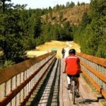
This hike includes crossing the Kettle River downstream of the falls on a 505 foot trestle bridge (Kettle River Bridge #5, now the Smitten Trestle), one of the longest on the Canadian Pacific Railway, which was redecked in 2004 as a joint military exercise with the CME and British and New Zealand troops. While approaching the bridge,...
This hike includes crossing the Kettle River downstream of the falls on a...

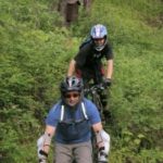
This former logging road was de-activated many years ago and now provides an easy hiking/biking trail that leads from Santa Rosa Rd. to Fife Rd. There are some great viewpoints along the trail of the Christina Lake valley, Grand Forks and Laurier as it follows through a 2nd growth forest, abundant with wildlife. The trail rises 340m...
This former logging road was de-activated many years ago and now provides an...

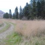
he region's newest Provincial Park offers a level grade through the wide open grasslands and dry forest, for relaxed hiking or bike riding. Established to protect the feeding and critical winter habitat for a large population of whitetailed and mule deer, elk and bighorn sheep, the scenery is panoramic, with the Kettle River flowing to the south...
he region's newest Provincial Park offers a level grade through the wide open...


This is another classic single-track mountain bike trail with a few steep technical descents. As a hiking trail it is loose and steep in sections but follows along the ridgeline providing spectacular scenic views of Christina Lake to the east and south. The steep up-hill sections and technical descents will keep all types of mountain bikers entertained....
This is another classic single-track mountain bike trail with a few steep technical...

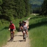
Opening in 2000, the Trans Canada Trail is a 21,500-kilometre recreational trail winding its way through every province and territory, from the Atlantic to Pacific to Arctic Oceans. When completed, it will be the world's longest recreational trail, linking close to 1000 communities and over 33 million Canadians. Now part of the Spirit of 2010 Trail, the...
Opening in 2000, the Trans Canada Trail is a 21,500-kilometre recreational trail winding...


At 25 km for the full trip, this leg of the trail is only for extremely dedicated hikers, as it will take a full day to reach Fife Road, but makes for an excellent half day biking trip. The rewards include passing through Paulson Tunnel, crossing the old Snowslide railway bridge and finally the ore loading tower...
At 25 km for the full trip, this leg of the trail is...

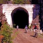
Prepare for a memorable ride. This section takes you up to the summit past the Peter Verigan memorial and on to Bulldog Tunnel, the longest on the CPR (1 km - be sure to bring lighting!) The route from Paulson to Castlegar station is about five hours, and has beautiful vistas of the Arrow Lake and the...
Prepare for a memorable ride. This section takes you up to the summit...


This hike will take you to one of the remnants from the smelter days on the KVR, the old limestone loading tower. Drive up Fife Road to the Trans Canada Trail crossing, which you'll find just around the bend from an old log barn, and land marked by the original Fife station building to your left. Head...
This hike will take you to one of the remnants from the smelter...


Hunting licences can be purchased at Christina Lake Esso, Home Hardware in Grand Forks or Grand Forks Service BC Centre. Home Hardware Street: 350 72 Avenue City: Grand Forks Province: BC Postal Code: V0H 1H0 Phone: 250-442-3135 Grand Forks Service BC Centre Street: 7290 2nd Street, Box 850 City: Grand Forks Province: BC Postal Code: V0H 1H0...
Hunting licences can be purchased at Christina Lake Esso, Home Hardware in Grand...

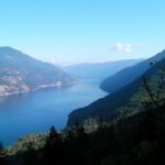
Another of our most popular short hikes, this stretch of the trail winds through the trees along the mountainside, opening to a vantage point overlooking the town with panoramic views of Christina Lake. You can see the newly railed sections above the Crow & Bear restaurant from the highway. Formerly the Kettle Valley Railway Trail, it became...
Another of our most popular short hikes, this stretch of the trail winds...


55 km west of Christina Lake, turn off Highway #3 at the Phoenix Ski Hill sign. Wonderful trails - just follow the posted map. Stop off to warm up at the dacha (cabin) by the viewpoint The sport can be as strenuous or gentle a workout as you desire. You will definitely be satisfied, surrounded by beauty...
55 km west of Christina Lake, turn off Highway #3 at the Phoenix...


57 km east of Christina Lake, adjacent to Nancy Greene Provincial Park. 45 km of trails have been developed by the BC Forest Service in cooperation with the Castlegar Nordic Ski Club.
57 km east of Christina Lake, adjacent to Nancy Greene Provincial Park. 45...
